LAMP Acquired Properties
LAMP Acquired Properties Interactive Map Viewer
To view a list of acquired properties through the program to-date, click the below button:
LAMP Property Acquisition and other funding sources
The Florida Communities Trust (FCT) is a Florida land acquisition grant program administered by the Florida Department of Environmental Protection (DEP). When the funding is available, grants are awarded annually on a competitive basis to local governments and non-profit environmental organizations for community-based parks, open space and greenways. These projects must further outdoor recreation and natural resource protection needs identified in the local governments’ Comprehensive Plans.
The following properties (previous to 2022) were acquired through the Land Acquisition and Management Program (LAMP) with assistance of the DEP Florida Communities Trust Program. More information can also be found at the DEP Florida Forever webpage. Additionally, properties acquired through the current LAMP program (2022 and later) are acquired through a variety of local, state and federal grant programs.
St. Johns County LAMP Properties
-
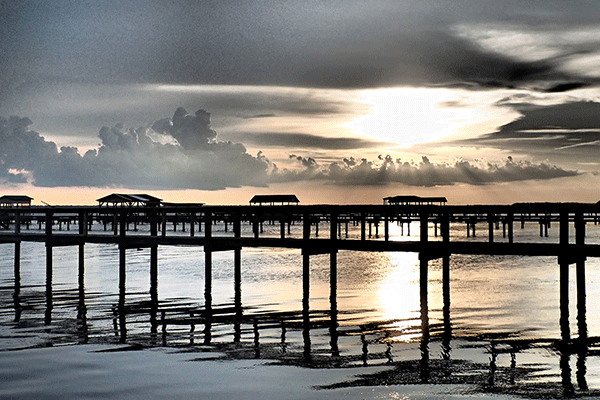
 Southeast Intracoastal Waterway Park
-
 Alpine Groves Park
 -
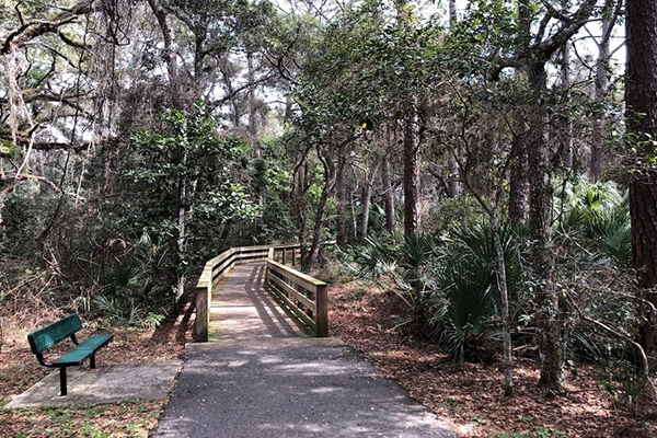
 Vaill Point Park
 -
 Fort Mose
 -
 Canopy Shores Park
 -
 Beluthahatchee Park
 -
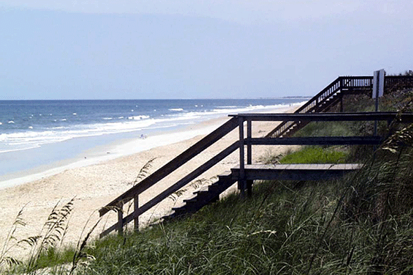
 Nease Beachfront Park
 -
 Mussallem Beachfront Park
 -
 Vilano Beach Oceanfront Park
 -
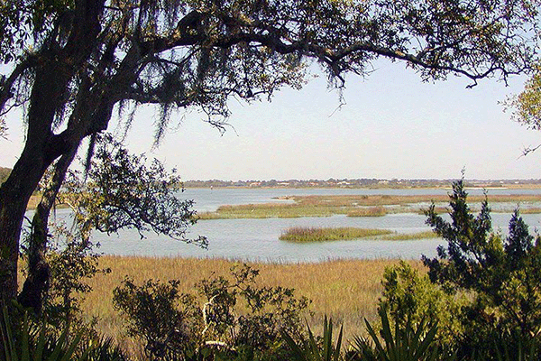
 Anastasia Island Saltmarsh
Preservation -
 Don Manuel Road
Preservation Tract -
 Bailey Park on Julington Creek
 -
 East Creek (Hawkins) Island Preserve
Southeast Intracoastal Waterway Park
Southeast Intracoastal Waterway Park contains 114 acres and is located between Crescent Beach and Marineland on Anastasia Island The park is situated between S.R. A1A and the Matanzas River in southeastern St. Johns County. S.R. A1A, which defines the eastern boundary of this site, was designated as a National Scenic Byway (known as A1A Scenic and Historic Coastal Highway) by the Federal Highway Administration (FWHA) in 2002. The Matanzas River defines the western boundary of this site and this river lies within the Guana Tolomato Matanzas (GTM) Natural Estuarine Research Reserve (NERR) boundary, the SJRWMD’s Northern Coastal Basins (NCB) and Surface Water Improvement Management (SWIM) Program. This is one of the last few remaining areas in St. Johns County open to shellfish harvesting (classified as Class II water by DEP). This project is made up of two parcels Boyd tract (112 acres) and Roth tract (2 acres).
Environment
The vegetative communities on these parcels are relatively rare and rapidly diminishing coastal ecosystems and are pristine areas of the basin very rich in bi-diversity. The predominate natural communities on these parcels consist of coastal scrub oak (uplands) and bay, estuary and saltwater marsh (wetlands). The upland portions of these sites consist mainly of coastal scrub oak between “S.R. A1A and marshlands, which includes such species as sand live oak, myrtle oak, wax myrtle, saw palmetto, yaupon holly, saltbush and bracken fern. One of the vegetated natural communities, scrub oak”, is listed as “imperiled” by the Florida Natural Areas Inventory (FNAI) because of its rarity or vulnerability due to extinction.
On the wetland portion of these sites the predominate vegetative natural communities consist of a mixture of saltwater marsh, bay and estuary vegetative natural communities. The bay and estuary vegetative natural communities are contiguous to the Matanzas River and are comprised of a mixture of smooth cordgrass and black needlerush. The Saltwater Marsh (wetlands) is located between the coastal scrub community and the bay-estuary vegetative natural communities and consists of smooth cordgrass, black needlerush, sea oxeye, black mangrove, glasswort and saltwort. The salt marsh and estuarine communities on these parcels are part of a much larger estuarine system in southern St. Johns County, identified by the St. Johns River Water Management District (SJRWMD) as providing critical habitat to a wide variety of wildlife, including listed species.
Species
Because the Matanzas River lies adjacent to these parcels, the river waters function as wildlife nurseries for the young of many species (including young turtles, oysters, etc.) and provide protection (shelter) needed for young species to mature. Listed species that may use the upland/wetland habitats for foraging or nesting on these parcels include the Anastasia beach mouse, Florida mouse, Florida manatee, eastern brown pelican, snowy egret, white ibis, American oystercatcher, black skimmer, Florida scrub jay, little blue heron, osprey, piping plover, tricolored heron, wood stork, southeastern American kestrel, eastern indigo snake and gopher tortoise.
Historical / Archaeological
There are at least ten known historical/archaeological sites on or within the vicinity of these parcels, with two known archaeological sites located on this site. These two known sites are currently enrolled on the Florida Master Site File listing. The Florida Master Site File has the two sites listed as, Sand Dollar Midden I (8SJ03131), which is an artifact scatter and shell midden dating from the first St. Johns Period, and Sand Dollar Midden II (8SJ03132), a coquina shell and shell midden dating between the Orange and St. Johns Period. U.S. Department of Interior, National Park Service’s, Fort Matanzas National Monument is located just south of the project site. The National Park Service is interested in maintaining the rural character within the immediate surrounding areas so the National Monument visitors can visualize life as it once was for a Spanish soldier during the 18th Century.
Alpine Groves Park
Alpine Groves River Park contains 54.5 acres and is located in northwest St. Johns County between the St. Johns River and William Bartram Scenic and Historic Highway (SR13). Access to the site is provided from William Bartram Scenic and Historic Highway, a magnificent winding scenic and historic highway defined by majestic canopy oak trees that overhang the road along the St. Johns River’s eastern shoreline. The park entrance is the first driveway south of Swiss Lane on the riverside of the highway.
Environment
The topography on the site varies significantly from the geologically unique bluff overlooking the St. Johns River to the lower elevations where the creek and wetlands bisect the site. The native vegetative communities located on the higher elevations consist of mixed hardwoods, temperate hardwoods and coniferous plantation. The native vegetative communities located on the lower elevations, in the proximity of the St. Johns River tributary, consist of mixed wetlands and hardwood forest. The mixed wetland hardwood community, located at the mouth of the tributary flowing into the St. Johns River, provides habitat for the American alligator, snowy egret and tri-color heron.
Area Species
According to the St. Johns River Water Management District’s Priority Habitat for Wetland Species Map this area is suitable habitat for 1-6 wetland dependent species. Other wildlife that can be found on this site include: osprey, owl, wild turkeys, many species of butterflies (zebra longwing, red admiral, gulf fritillary, buckeye, southern hairstreak, monarch, cloudless sulphur, zebra swallowtail, tiger swallowtail, spicebush swallowtail, giant swallowtail, black swallowtail and long-tailed skipper) fox, deer, gopher tortoise, eastern indigo snake, Florida pine snake and the endangered manatee.
Historic and Archaeological Resources
The three historic structures located on this site were built during the nineteenth and twentieth centuries. These are the last remaining historic physical structures in this area that provide a unique opportunity for the county to educate citizens, as well as travelers, about the rich local citrus history and economic development during the 1900s in northwest St. Johns County (Fruit Cove, Orangedale and Switzerland).
The main structure is a two-story farmhouse built circa 1900. The shed/garage, located northeast of the house, still contains much of the grove’s machinery for processing fruit grown on the site. The most interesting of the three buildings is the two-story board and batten framed structure, which was used by the former owner to store his curios collected from around the country. These curios were put on display for the local schoolchildren and tourists to see. There are still remnants of orange/lemon groves on this site.
Unfortunately, due to the hard freeze in 1983, many of the North Florida existing groves were destroyed and those groves that survived were then destroyed the following year. Although this site has seen better days as a thriving orange/lemon grove, the site still contains many secrets of the past. Due to the rapid growth in northwest St. Johns County and the subsequent large influx of new residents since the mid-1980s, much of the area’s history has been destroyed.
Many scenic vista views of the St. Johns River can be observed from this site. The William Bartram Scenic and Historic Highway functions as a linear “greenway” connecting this site with the southern strategic habitat area (as designated by the Fish and Wildlife Conservation Commission (FWCC) in Duval County.
Vaill Point Park
The Moultrie Creek / Intracoastal Park (Vaill Point) contains 23 acres, bordered on the east by the Intracoastal Waterway and on the north by Moultrie Creek. Accessible from US 1 via Vaill Point Road and Sturdivant Road, this site constitutes the last remaining parcel from an 80-acre parent tract owned by the Vaill Family since 1918. Over the years, the Vaill Family utilized this site for passive recreational activities such as family picnics and horseback riding.
Acquisition of this project site has provided this community with a much needed neighborhood/community park, provided additional access to the Moultrie and Intracoastal Waterways, improved the surrounding water quality, connected St. Johns County’s Northeast Blueway – Phase II with Duval County’s Blueway – Phase I, promoted a local canoe blueway trail and provided additional environmental resources protection. Acquisition and preservation of this site has furthered the established initiatives started by NOAA/DEP through the Guana Tolomato Matanzas (GTM) National Estuarine Research Reserve (NERR), the DEP through the Guana, Tolomato, Matanzas Shellfish Harvesting Task Force and the SJRWMD through the Northern Coastal Basins Program. All of the project site characteristics, as stated above, are consistent with the St. Johns County 2015 Comprehensive Plan’s initiatives.
Environment
Elevated on a geologically unique bluff (20-25 feet on the east side) the site overlooks the Intracoastal Waterway and Moultrie Creek. Many panoramic and vista views can be observed of the surrounding waterways from the densely vegetated plant communities containing plant species characteristic of North Florida. These native vegetative communities vary with the topography and consist of Live Oak/Upland Temperate Hammock, Temperate Hardwoods, Oak/Pine Forest and Saltwater Marsh. The Bluff (Mesic Uplands) is contained within the Live Oak / Upland Temperate Hammock and the Temperate Hammock communities that line the entire northern and northeastern boundaries (approximately 1146 linear feet) of the site along both the Moultrie Creek and the Matanzas River. The Bluff (Mesic Uplands) vegetative community is classified as imperiled in Florida. According to the Florida Natural Areas Inventory (FNAI), there are only 19 other locations in the State of Florida where this occurs. The very high quality native vegetative communities consist of mature canopy trees and densely vegetated understories. There are only a few locations in the uplands and along the wetlands where re-vegetation of native vegetative communities needs to occur. Where erosion has occurred in both the uplands and the wetlands areas will need to be re-vegetated with native vegetation. The bluff is of particular interest in the Live Oak community where existing oaks, magnolia and hickory trees extend to the actual bluff edges.
Species
The Saltwater Marsh community contains habitat for several State and Federal listed wading birds including the least tern, least bittern, yellow-crowned night heron, reddish egret, snowy egret, tri-colored heron, brown pelican, bald eagle and the white ibis. Both the least tern and the bald eagle are listed as Threatened (T) and the brown pelican, little blue heron, reddish egret and tricolor heron are listed as Species of Special Concern (SSC) by the Florida Fish and Wildlife Conservation Commission (FWCC). The Live Oak / Upland Temperate Hammock, consisting of large pines lying along the western bluff of Moultrie Creek, provides nesting and/or roosting sites for several State and Federal listed species including bald eagle, peregrine falcon and osprey. The Oak / Pine Forest Community currently has two inactive gopher tortoise burrows. The Florida Fish and Wildlife Conservation Commission (FWCC) list the gopher tortoise as Threatened.
Fort Mose
In 1996 the State of Florida purchased a 2.5 acre Fort Mose site strategically located on the Tolomato River (a part of the Intracoastal Waterway) which not only provides the county residents with an opportunity to access this water body, but also provides St. Johns County with the opportunity to become interconnected with Duval County to the north and the City of St. Augustine and Flagler County to the south. In 2003, with the assistance of the Trust for Public Lands (TPL) and the Florida Community’s Trust (FCT) program, St. Johns County purchased the 8-acre site north of the original Ft. Mose site. Access to this site is from US 1 via Isla Drive.
Vegetative Communities
The site is comprised of three distinct Vegetative Communities, characterized by their Florida Land Use Cover Forms Classification System (FLUCFCS) as Maritime Hammock, Estuarine Tidal Marsh and Ruderal (common plant species). The maritime hammock community dominates the site. The dominant plants species within this community includes live oak, red bay, and yaupon holly. The estuarine tidal marsh community ranges from intertidal marsh dominated by cordgrass. (Spartina alterniflora) to high marsh dominated by saltgrass (Distichlis spicata). Traversing the marsh are numerous tidal creeks and rivulets. Common plant species observed on this site include red maple, southern magnolia, laurel oak, saw palmetto, cabbage palm, pignut hickory, loblolly pine, southern red cedar, wax myrtle, horrible thistle, stinging nettle, black needlerush, smooth cordgrass, sea oxeye, and saltwort.
Wildlife
Wildlife observed on this site includes white ibis, little blue heron, tricolored heron, Florida sandhill crane, wood stork, great blue heron, and great horned owl. This site also contains an established great heron rookery and wood stork feeding grounds.
Historic Significance
The Historic Significance of the Fort Mose site to the African-American cultural history is tremendous. In 1738, Garcia Real de Santa Teresa de Mose, known as Fort Mose, (mosay) was established as the first legally sanctioned community of freed slaves in what is now the United States. At that time the site was located approximately two miles north of the Spanish Fort at St. Augustine, Fort Mose served as the northern defense line to the garrison town.
Most of the community of Fort Mose consisted of escaped or runaway slaves from the British colony of South Carolina. The Spanish government gave them freedom in exchange for their conversion to Catholicism and their allegiance to the Spanish crown. In 1740, English forces attacked Fort Mose captured and destroyed many inhabitants. However, some inhabitants of Fort Mose escaped and moved to the safety of St. Augustine’s Spanish Fort – Castillo de San Marco.
At the urging of Spain, Fort Mose was rebuilt just north of the original site as a packed earthen fort, surrounded by a six-foot moat. Fort Mose thrived as a separate community from St. Augustine until 1763 when Spain ceded Florida to the British. The British occupied Fort Mose until 1775, then the Minorcan farmers sporadically inhabited the site until 1821. The site was abandoned until 1986, when it was relocated according to modern-day historic research.
From 1986-1996 this site was extensively researched and an archaeological investigation was completed. A traveling museum exhibit, Fort Mose: America’s Black Fortress of Freedom, was developed and opened at the Museum of Science and History in Jacksonville in February 1994.
In 1997, the Fort Mose Historical Society was established as a citizen support organization to the site. Since its establishment, the Society has worked closely with the Florida Park Service to increase the opportunity for experiencing and appreciating the story of Fort Mose.
Recreation, Preservation, and Protection
A Master Plan was commissioned for the site, which includes plans for an 8,000 square foot Interpretative Museum building to provide a permanent home for the Black Fortress of Freedom Exhibit. There are opportunities for historical and natural interpretation, hiking trails, boardwalks, picnicking, observation platform, canoe/kayak platform, entrance road, parking lot and site security.
Because this project site is located on the Intracoastal Waterway, this site is a piece of a massive puzzle that interconnects federal, state and local initiatives to preserve, protect and maintain the natural resources (vegetative communities, wildlife habitat, improve water quality and protect shellfish harvesting areas) along the Intracoastal Waterway. The federal initiative is being pursued by the National Oceanic and Atmospheric Administration (NOAA) and this administered through the Department of Environmental Protection (DEP) in the implementation of the Guana, Tolomato, Matanzas (GTM) National Estuarine Research Reserve (NERR) Management Plan. Other State initiatives being pursued by DEP and the SJRWMD include the GTM Water Quality Task Force and Northern Coastal Basins Program, respectively.
In addition, Duval County’s Northeast Blueway Phase I – Pablo Creek CARL application approved by the ARC in 2000 as a Category A project and the St. Johns County recent Northeast Blueway Phase II – Tolomato and Matanzas Rivers Florida Forever (FF) application all helped provide further protection to the natural resources along the Intracoastal Waterway. Through these programs and initiatives the federal, state and local agencies are coordinating to implement the mutual goal of preservation, protection and maintenance of the natural resources along the Intracoastal Waterway.
More information is available about the site, current programs and events through the Florida State Parks website.
Canopy Shores Park
Canopy Shores Park is a 33 acre site located within the St. Augustine Shores Planned Unit Development (PUD) located off US 1. Direct access to the site is provided off Shores Blvd. on to Christina Dr. and this site lies across the street from the St. Augustine Shores’s Riverview Club property.
As the name implies, Canopy Shores Park is filled with majestic canopy oak trees defined by three distinct vegetative communities, hydric hammock, estuarine tidal marsh and floodplain swamp. The hydric hammock vegetative community dominates the majority of this site (27 acres), consisting of dense, mature canopy of live oaks, laural oaks and red cedar containing an understory of yaupon holly and cabbage palm. Along the eastern portion of the site lies ground cover material consisting of Spanish needles, American beauty berry and blackberry, while the western area contains a dense cover of saw palmetto, sparkle berry, deer berry and wild petunia.
Environment & Species
The floodplain swamp, consisting of 3.5 acres, lies adjacent to the man-made creek that bisects the site from the Matanzas River inland to the southwest. Along the southern creek edge, the floodplain swamp is filled with dense lizard trails, marsh pennywort, buttonbush, netted chain fern and wax myrtle.
2.5 acres of estuarine tidal marsh vegetation lies along the Matanzas River edge and is defined by the sea oxeye daisy, needle rush and cord grass. The majority of the wildlife species located on this site are located in the estuarine tidal marsh vegetation area and the species observed include bald eagle, brown pelican, least tern, yellow crowned night heron, reddish egret, snowy egret, tri-colored heron and white ibis.
Since Canopy Shores eastern boundary is defined by the Matanzas River, it lies within an archaeological high probability area and contains one shell midden (SJO3169) according to the master site file.
The Intracoastal Waterway
Because this project site is located on the Intracoastal Waterway, it is another piece of a massive puzzle that interconnects federal, state and local initiatives to preserve, protect and maintain the natural resources (vegetative communities, wildlife habitat, improve water quality and protect shellfish harvesting areas) along the Intracoastal Waterway. The federal initiative is being pursued by the National Oceanic and Atmospheric Administration (NOAA) and is administered through the Department of Environmental Protection (DEP) in the implementation of the Guana, Tolomato, Matanzas (GTM) National Estuarine Research Reserve (NERR) Management Plan. Other State initiatives being pursued by DEP and the SJRWMD include the GTM Water Quality Task Force and Northern Coastal Basins Program, respectively.
In addition, Duval County’s Northeast Blueway Phase I – Pablo Creek CARL application was approved by the Acquisition and Restoration Council (ARC) in 2000 as a Category A project and St. Johns County’s Northeast Blueway Phase II – Tolomato and Matanzas Rivers Florida Forever (FF) application was approved by ARC in 2001. Through these programs and initiatives the federal, state and local agencies are coordinating to implement the mutual goals of preservation, protection and maintenance of the natural resources along the Intracoastal Waterway.
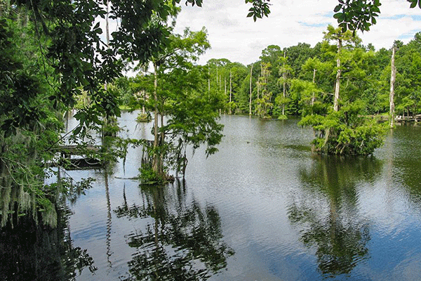
Beluthahatchee Park
Beluthahatchee Park is located on the William Bartram Scenic Highway (SR 13) approximately one-fourth of a mile south of Roberts Road and approximately 200 feet north of Cricket Hollow Lane. The Beluthahatchee Park is a four (4) acre park located within the 70-acre tract of land purchased by Stetson Kennedy in 1948 after the 18 acre Beluthahatchee Lake was created by impounding Mill Creek in 1945. This lake meanders through a natural basin and is surrounded by high bluffs, currently owned by the Lake Dwellers Association, a non-profit Florida corporation formed by the lakefront residents. In 1949 the 70 acre tract was subdivided and platted by the owner/developer Stetson Kennedy who recorded the restrictive covenants setting aside land in perpetuity as a wildlife refuge, and stipulating that residential construction be consistent with the developer’s goal of “serving as a working demonstration that human and natural habitat need not be mutually exclusive, but can coexist in harmony.”
Vegetation and Species
The perimeter of the property is surrounded by a heavy canopy of native vegetation overstory consisting of mixed coniferous and hardwood defined by live oak, laural oak, water oak, long leaf pine and cabbage palms. The native vegetation understory consists of saw palmetto, southern magnolia, water and laural oak. The lake native vegetation overstory consists of pignut hickory, sweet gum and bald cypress and the understory consists of sweet gum, southern magnolia and swamp dogwood.
Much of the perimeter native vegetation has been preserved, despite intensive development around its border. The Beluthahatchee enclave provides wildlife habitat and continues to serve as a rookery and roosting place for ospreys, eagles, snowy egrets, tri-colored heron, white ibis, little blue heron, wood storks, black-crow night herons, wood ducks, anhingas, purple gallinules, bronze grackles, red-winged blackbirds and many other species.
A Literary Landmark
On April 6, 2005, Kennedy was inducted into the Florida Artists Hall of Fame, and he was nominated for the National Heritage Award presented at the Library of Congress. The Stetson Kennedy residence is a National Literary Landmark, as recognized by the Friends of the US Library.
Kennedy’s career as an author began in 1942 with Palmetto Country, a volume in the American Folkways Series edited by Erskine Caldwell. This was followed by Southern Exposure in 1946, Jim Crowe Guide in 1956, and The Klan Unmasked in 1957, based upon Kennedy’s infiltration of the Klan following WW II. Numerous awards received by Kennedy during the course of his career are indicative of the significance of his life work
Making and Preserving History
History was made at Beluthahatchee during the latter half of the 20th century by both Kennedy and his frequent house guest, America’s legendary folk balladeer Woody Guthrie (“This Land is Your Land,” etc.). The final draft of Woody Guthrie’s autobiography, Seeds of Man, and 80 songs were composed while Guthrie was in residence at Beluthahatchee. Almost all of which had to do with the “sense of place”, and human rights issues inspired by Kennedy’s writings. The 2003 nomination by the Florida Center for the Book and the Council for Florida Libraries the Friends of Libraries – USA designated Beluthahatchee a Literary Landmark (No. 83 in the National Register). An additional marker, in Kennedy’s name, was also approved to be erected following his demise.
In 2005, the 88-year old Kennedy received a life estate on this property from the Florida Community Trust’s land acquisition program. The majority of the site will be left in its current state, consisting of four original lots and Kennedy home
Visitor and Recreational Opportunities
Through the acquisition of the Beluthahatchee Park, St. Johns County continues the legacy of Stetson Kennedy and his vision for its future as a literary landmark and to carry forward the shared Kennedy/Guthrie three-fold legacy of devotion to human rights, mother earth and the traditional culture.
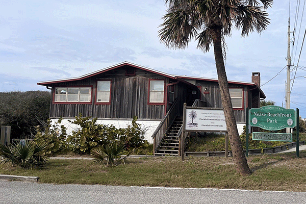
Nease Beachfront Park
Nease Park is located 1 mile north of the St. Augustine Inlet on A1A Scenic & Historic Coastal Byway about 230 feet from the Atlantic Ocean. The Nease Park site is located within the vicinity of the Vilano Waterfront Community boundary area designated as a Community Redevelopment Area (CRA). Nease park site was the previous residence of Allen Nease built in the 1950s on the eastern central edge of a 3.2-acre site.
Environment
There is a dense wind and salt pruned coastal scrub and live oak hammock located adjacent to A1A Scenic & Historic Coastal Byway. The live oak (Quercus virginiana) is interspersed with red cedar (Juniperus silicicola) along the marsh fringe. The coastal understory consists of saw palmetto (Serenoa reopens) and yaupon holy (Ilex vomitoria) that is interspersed with some myrtle oak (Ouercus mytifolia). The site topography varies slightly where the high marsh gradually slopes into the low marsh on the western edge of the property. The high marsh consists of salt grasses (Distichlis spicata), sand cordgrass (Spartina bakeri) and salt meadow cord grass (Spartina patens) that gradually slopes into the low marsh consisting of nine (9) small scrub islands sporadically located among the smooth cord grass (Spartina alterniflora) and black mangroves (Avicennia germinans).
The saltwater marsh community provides habitat for several state listed species of special concern (SCC) classified as wading birds, including white ibis, snowy egret, tri-colored heron, little blue heron and one endangered species, the wood stork. The colorful painted bunting, which is, enjoyed by so many bird watchers, can be observed on this site, as well as the Florida scrub jay and the gopher tortoise.
Because this project site is located within the Florida Forever Northeast Florida Blueway Phase II, this site is another piece of a massive puzzle that interconnects federal, state and local initiatives to preserve, protect and maintain the natural resources (vegetative communities, wildlife habitat, improve water quality and protect shellfish harvesting areas) along the Intracoastal Waterway. The federal initiative is being pursued by the National Oceanic and Atmospheric Administration (NOAA) and it is administered through the Department of Environmental Protection (DEP) in the implementation of the Guana, Tolomato, Matanzas (GTM) National Estuarine Research Reserve (NERR) Management Plan. Other State initiatives being pursued by DEP and the SJRWMD include the GTM Water Quality Task Force and the Northern Coastal Basins Program, respectively.
History
The Allen Nease residence is listed on the Florida Master Site File (8SJ4962). The majority of the listed structure was built in the 1930s and 1940s. Mr. Nease was a pioneer of Florida’s reforestation and conservation efforts in the mid-20th century. The unique interior of this home reflects the owner’s professional forestry background. This home contains heart pine wood floors, 12-inch bald cypress wall planking, native hardwood ceiling planking and solid bald cypress ceiling beams in the living room.
Allen Nease graduated from North Carolina State University and went to work with the US Forest Service in the Apalachicola National Forest where he planted trees, supervised timber sales and fought “redneck poachers” who were undermining his efforts. In 1940, he was hired by the Florida Forest Service as the first County Forester in the state, selling the need for forest and soil conservation all the way from Suwannee to Washington County. Because Allen Nease planted over 55 million pine trees throughout the north Florida area from Pensacola to St. Augustine, he became known as “Johnny Pine Tree” (instead of Johnny Apple seed). In 1947, Allen Nease came to St. Johns County to manage 17,000 acres of overcut, overworked timberland for Robinson Improvement Company where he established a re-forestry program.
In 1971, Allen Nease was elected to the St. Johns County School Board where he served as Chairman for 17 years and became the School Board’s driving force for 24 years. While on the School Board, Mr. Nease won the battle to build and develop what is now known as the First Coast Technical College. From 1971-1984 until his death, Mr. Nease continued his timber growing and conservation efforts on his personal land holdings.
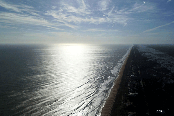
Mussallem Beachfront Park
The Mussallem Beachfront Park property is an 8.5 acre site located in eastern St. Johns County. It is bordered on the east by the Atlantic Ocean and on the west by the Intracoastal Waterway. It is accessible from Highway A1A.
Environment
The entire project site consists of native forested vegetative communities that have not been subjected to significant disturbances or alteration as a result of current or past human activities. There is one acre east of A1A, which includes beach dune, and unconsolidated substrate, which has been a frequent nesting beach for Sea Turtles in the past. The western portion of the property is 5 acres maritime hammock, 2 acres of tidally influenced salt marsh and around 1/3 of an acre of upland islands mixed throughout the salt marsh that are adjacent to the Tolomato River. Previously a portion, which encompasses approximately 1 acre of dune and hammock on the west side of A1A, was removed to demonstrate the location of a shared access road for the proposed developments.
The maritime hammock is in excellent condition and contains beautiful examples of the relationships of the key plants within this community. It is bounded by a dune to the east that ranges from 8-10 feet high, except for the northeast corner where the dune has been removed and the tidal marsh to the west. The area of the hammock that is exposed because of the loss of the dune has been negatively impacted by the dominant northeast wind, and its health will improve once the dune area has been restored. The interior of the hammock remains in pristine condition. The beach dune community is in good condition. Its health has been compromised due to the location of the road; however, minimal planting of more sea oats, beach morning glory, and dune panic grass can enhance the health of the beach dune community. The tidal marsh community is in excellent health and it has tremendous value since most of the surrounding marsh is either privately owned or out of the view of the general public. The black needle rush, salt marsh cordgrass, and saltwort are surrounded by beautiful pockets of upland islands that allow for a nice viewing area for the public to enjoy this habitat.
The beachfront portion of the park has been a nesting location for Sea Turtles and its continued protection will enable the turtles to nest here for the future. The loggerhead, green, and leatherback turtles all require beaches without interference from lights to ensure a successful emergence of hatchlings and a safe journey for them to the ocean. The creation of a passive park in this area has preserved the health of this important stretch of beach.
Mussallem Beachfront Park is located in a high probability archaeological area, with two properties listed on the Florida Master Site File nearby. Acquisition of this site through a grant with the Florida Communities Trust removed it from future potential development. Significant neighborhood opposition to this development brought this property to the attention of St. Johns County for acquisition as a community park. The County is working with the adjacent property developer to co-locate access roads and parking and landscaping to minimize impacts to the fragile dune ecosystem, as well as the variety of wildlife that make this park their home.
Funding sources for acquisition of this site included the St. Johns County General Fund, impact fees, and commercial paper. These funds were matched by a Florida Communities Trust grant award for joint acquisition with St. Johns County.
Vilano Beach Oceanfront Park
The Vilano Beach Oceanfront Park site is located on 1.7 acres of beachfront property at 2750 Anahma Drive in Vilano Beach. The park sits nestled in the sand dunes, bordered to the east by the Atlantic Ocean, and to the west by Anahma Drive. To the north is the Vilano Beach Ramp, which allows residents and visitors direct driving access to the beach. Located directly beside the ramp, St. Johns County has built a beach pavilion and small splash park. Amenities include outside showers, benches, bicycle racks, and restrooms. A hot spot in St. Johns County, the Vilano Beach Ramp will see up to, and sometimes more than, 150 vehicles a day. The site is already home to the National Skim Boarding Championships and an Easter Sunrise Service that has over 700 in attendance each year.
The Vilano Beach Oceanfront Park lies within the Vilano Beach Community Redevelopment Area, the Vilano Beach Waterfronts Florida Community and Vilano Beach Main Street boundaries. The project site is identified on the Scenic and Historic A1A Coastal Byway and the East Coast Greenway, an urban trail that runs from Key West, Florida to Calais, Maine. As stated previously, the Vilano Beach Oceanfront Park sits adjacent to the Vilano Beach Ramp and the Vilano Beach Pavilion. Both of these sites are listed on the St. Johns County Recreation and Parks inventory, maintained and operated by St. Johns County Recreation and Parks Department.
St. Johns County utilized grant funding from Florida Communities Trust to acquire the Project Site. Funding sources for acquisition of this site included the St. Johns County General Fund, impact fees, and commercial paper. These funds were matched by a Florida Communities Trust award for joint acquisition with St. Johns County.
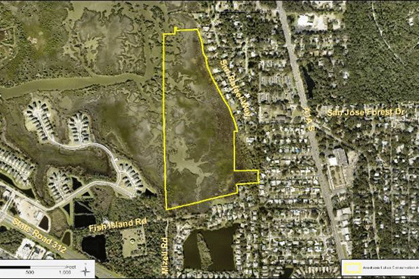
Anastasia Island Saltmarsh
Preservation
This 50-acre salt marsh property, located along the west-central portion of Anastasia Island and just north of State Road 312, was acquired in January 2024 and represents the first acquired property after the reinitiation of the St. Johns County Land Acquisition and Management Program (LAMP) in 2021. The property will remain in its current natural state as a preservation area. Not only will this acquisition ensure the preservation of sensitive salt marsh habitat, but it will also continue to help buffer the surrounding area from storm events. Although access to the property is very limited, there may be opportunities for wildlife viewing within the salt marsh areas at a distance or from the water.
The LAMP Conservation Board reviewed the property in 2022 using their updated evaluation matrix. The property was then presented as a recommended property for preservation to the BOCC in March 2023, and with their approval, authorized the property for acquisition through the Real Estate Department.
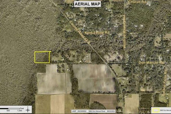
Don Manuel Road
Preservation Tract
This 7-acre property is located at the western end of Don Manuel Road in Elkton, off County Road 13 South. The LAMP Conservation Board recommended the property to the Board of County Commissioners in March 2024 and the property was then able to be quickly acquired in September 2024. The property will be preserved in its natural state and builds onto an adjacent conservation lands corridor in the area. It sits along and to the east of the 4,529-acre St. Johns River Water Management District Deep Creek North Conservation Area and to the south of a 70-acre preservation tract associated with the Deep Creek Regional Offsite Mitigation Area owned by St. Johns County. The Don Manuel Road preservation property contains mostly floodplain swamp associated with Deep Creek, a tributary of the St. Johns River on its western portion, with a small portion of uplands dominated by pine flatwoods on the eastern portion.
Bailey Park on Julington Creek
The northern Bailey Ranch parcels acquisition (Bailey Park) total about 3 acres along Julington Creek, on the northern side of Bishop Estates Road in northwestern St. Johns County. This property is comprised of two former residential lots and is part of a larger and phased acquisition of the 67-acre Bailey Ranch, located immediately to the south. The larger working ranch is anticipated to be acquired as a companion property under a protective easement through the Florida Department of Agriculture and Consumer Services Rural and Family Lands Program. The Bailey Park acquisition contributes to the preservation of open space and trees and will provide the first St. Johns County Park with water access on Julington Creek. The County anticipates repurposing the former residential structures for park use and providing public environmental education opportunities. Other envisioned improvements include restoring the shoreline, providing public calm water kayak launch with potential pier and park pavilions. The proposed Julington Creek access will replace the kayak launch located at Alpine Grove Park 4 miles south on the St. Johns River, due to the rough water and strong currents there.
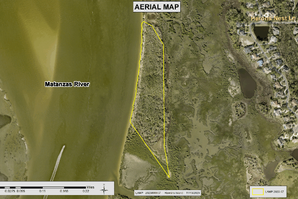
East Creek (Hawkins) Island Preserve
This unique 14-acre upland island acquisition, located on the eastern bank of the Intracoastal Waterway within the Matanzas River, is part of a large salt marsh conservation corridor. The island’s located just north of the mouth of East Creek, across from the mouth of Moultrie Creek between the Marsh Creek and St. Augustine South residential areas. The preserved island is viewable by watercraft only. The County’s acquisition adds to a corridor of sovereign-submerged state lands, a City of St. Augustine owned island to the north and an adjacent Marsh Creek conservation easement, which preserves sensitive salt marsh and maritime hammock habitat.Special Projects
St. Johns County’s Greenway, Blueway and Trails
This content has been archived. To view, visit the Growth Management Document Archives.
Recreational Opportunities
Discover St. Johns County recreational opportunities with the St. Johns County Parks Location Map which includes State, County and City maintained parks and in our Parks and Recreation section.